Smreczyński Pond - Tatra National Park
No weather data
0.0 /5
Number of ratings: 0
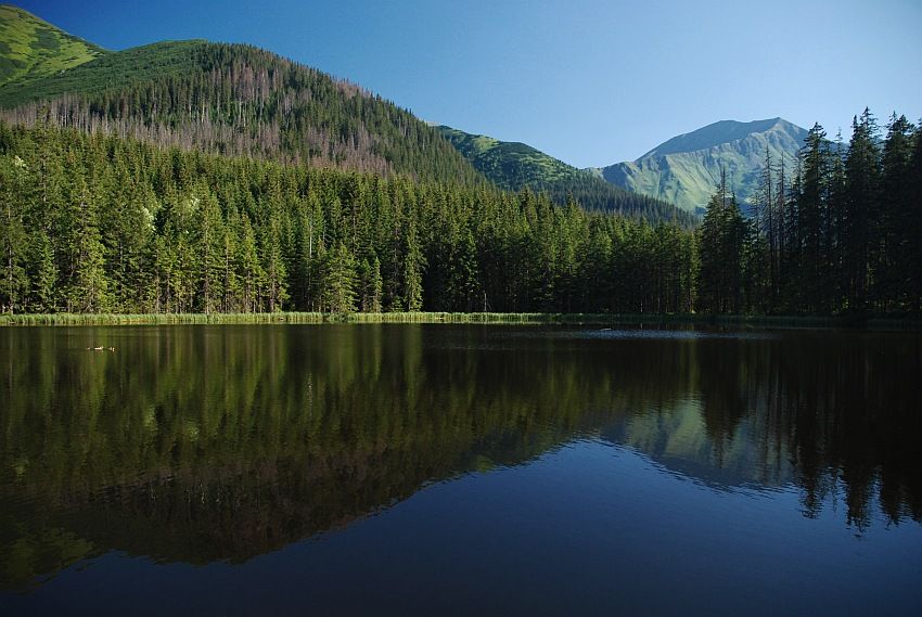
It is located at the outlet of the Pyszniańska Valley and Hala Smreczyna, above the Kościeliska Valley, at an altitude of 1226 m above sea level. The lake was created in a depression between moraines of two glaciers. The average depth is 1.8 m, maximum depth 5.3 m, area 0.75 ha, capacity 13,540 m³. The water transparency is only 1.5-2 m. The entire pond is surrounded by forest, and above it are visible peaks: Smreczyński Wierch (2086 m above sea level), Kamienista (2126 m above sea level), Błyszcz (2158 m above sea level), the slopes of Starorobociański Wierch ( 2,178 m above sea level). The Polish-Slovak border runs along them. Near the pond there are two overgrown glades in the forest: Wyżnia Smreczyńska Polana and Niżnia Smreczyńska Polana. Highlanders used to think that the lake has no bottom. According to legend, when a gazda began to dig a drainage ditch to drain it and turn it into a meadow, a voice from the water warned him that it would sink all the villages, all the way to the sea. Smreczyński Pond was visited and admired by many famous artists. They painted him, among others Walery Eljasz-Radzikowski, Wojciech Gerson, Leon Wyczółkowski. Stefan Żeromski described him in the second volume of Popiołów, and Seweryn Goszczyński in the piece Oda.
Komentarze
No results
Nearby places
Raptawicka Cave - Kościeliska Valley - Tatra National Park
Category: Caves and rock formsA cave 150 m long and 15 m deep, located in Raptawicka Turnia, about 180 meters above the bottom of the Kościeliska Valley. The main hall of the Raptawicka Cave lies at the intersection of several tectonic cracks and...
2 km
Cracow Gorge - Kościeliska Valley - Tatra National Park
Category: Caves and rock formsLateral, orographically right branch of the Kościeliska Valley in the Polish Western Tatras. It is deeply cut into the slopes of the Ciemniak and Upłaziańska Kopa massifs. Kraków Gorge is considered the most...
3 km
Ciemniak - Tatra National Park
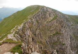
Category: Peaks and valleysThe westernmost peak belonging to the Czerwone Wierchów massif in the Western Tatras. Slovak sources state a height of 2090 m. Ciemniak is built of dolomites with thawing of mid-Triassic age limestone, only the Hard...
4 km
Mroźna Cave - Kościeliska Valley - Tatra National Park
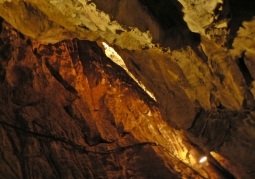
Category: Caves and rock formsThe most visited cave is located in the eastern slope of the Kościeliska Valley. It is located in the Organ massif, 120 meters above the bottom of the valley. The cave is one of the smaller caves of the Tatra...
4 km
Nearby places

Raptawicka Cave - Kościeliska Valley - Tatra National Park
Category: Caves and rock formsA cave 150 m long and 15 m deep, located in Raptawicka Turnia, about 180 meters above the bottom of the Kościeliska Valley. The main hall of the Raptawicka Cave lies at the intersection of several tectonic cracks and...
2 km

Cracow Gorge - Kościeliska Valley - Tatra National Park
Category: Caves and rock formsLateral, orographically right branch of the Kościeliska Valley in the Polish Western Tatras. It is deeply cut into the slopes of the Ciemniak and Upłaziańska Kopa massifs. Kraków Gorge is considered the most...
3 km

Ciemniak - Tatra National Park
Category: Peaks and valleysThe westernmost peak belonging to the Czerwone Wierchów massif in the Western Tatras. Slovak sources state a height of 2090 m. Ciemniak is built of dolomites with thawing of mid-Triassic age limestone, only the Hard...
4 km

Mroźna Cave - Kościeliska Valley - Tatra National Park
Category: Caves and rock formsThe most visited cave is located in the eastern slope of the Kościeliska Valley. It is located in the Organ massif, 120 meters above the bottom of the valley. The cave is one of the smaller caves of the Tatra...
4 km
